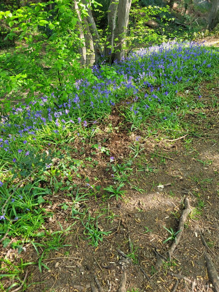
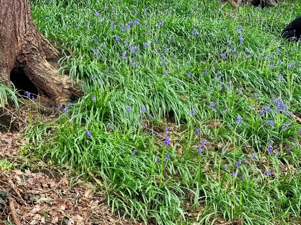
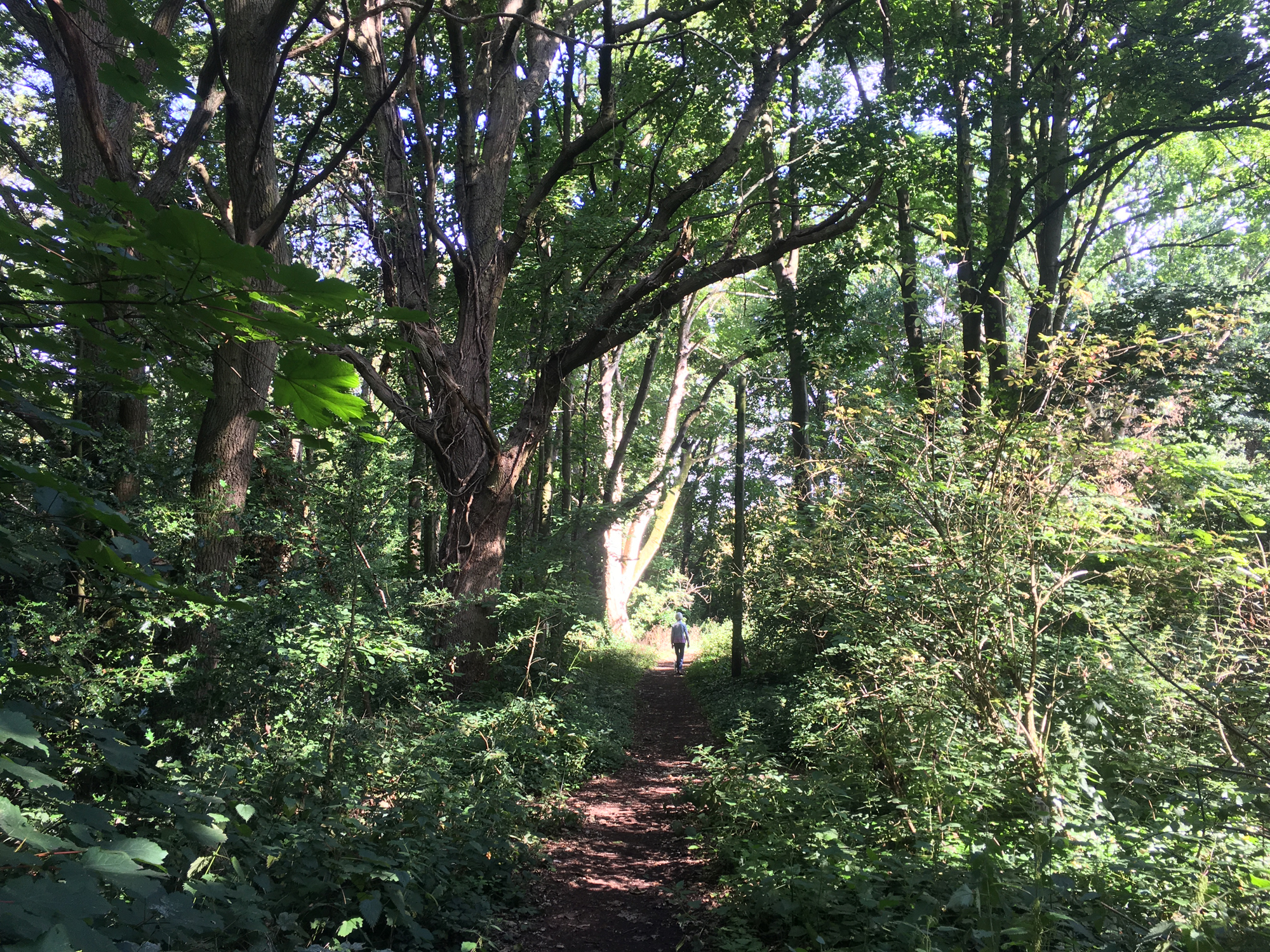
Those of you spending time on the Heath or in Beech Bottom Dyke will have seen the Bluebells popping up as a lovely reminder of the season. Below are a few photos to enjoy, courtesy of Mary North.
including Beech Bottom Dyke and Sandridge Road Wastes
Those of you spending time on the Heath or in Beech Bottom Dyke will have seen the Bluebells popping up as a lovely reminder of the season. Below are a few photos to enjoy, courtesy of Mary North.
The Friends are happy to take questions about, and report incidents regarding, the heath, dyke and wastes to the council. Residents can now also report incidents directly to the council when logged ino the their account on the SADC website.
FoBH chair, David Pearce, noted that this is a useful tool as “local can check to see whether the incident has already been reported by someone else or to obtain an update”.
Please join us on Sunday 24th March and help look after your heath.
Litter pick & general tidy up. Meet at Heath House, Heath Farm Lane AL3 5AE from 9:30 am.
Litter-pickers and bags will be provided. Accompanied children welcome.

Peter Cook retires after chairing the FoBH for an incredible 25 years.
Peter Cook stepped back as chair at the recent AGM, and the occasion was marked with a celebration of his efforts.
Fellow founding member Jenny Faldon said:
“Peter took on the post of chair, rather reluctantly, in 1999, and grew the FoBH over 25 years. From being a small local group, the Friends are now a point of contact for residents’ concerns which Peter deals with courteously, whether it be to field complaints or to accept thanks for an issue resolved.
Peter chairs committee meetings collaboratively, allowing all contributions to be expressed and drawing the threads together in an agreed statement of intent. Under his stewardship, committee membership has become more diverse in both age and gender.
Over the years, Peter has been recognised by local and county councils in his leadership of FoBH as a constructive and forward-looking organisation. Links with local councillors, schools, and residents speak much for his calm and focused manner. We are fortunate in having David Pearce to fill those big shoes and to build on Peter’s legacy, and glad that Peter will remain as a committee member.”
Thank you Peter, for your and generous efforts over the years. We look forward to your “heckling from the back-benches”.
Over £100,000 donated to renovate what was a tired looking play area
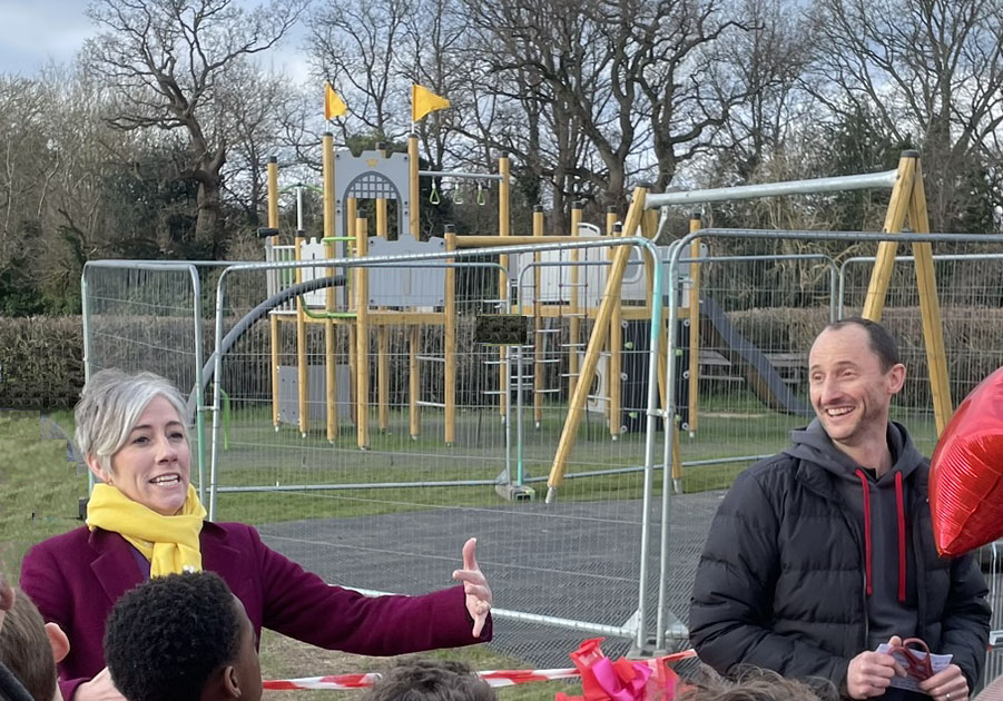
On the 3rd February 2024 the renovated play area was opened by local MP, Daisy Cooper. On the right is David Pearce, who along with an enthusiastic group of parents faced a formidable task of collecting over £100,000 to fund the installation of new play equipment, some which is shown in the background.
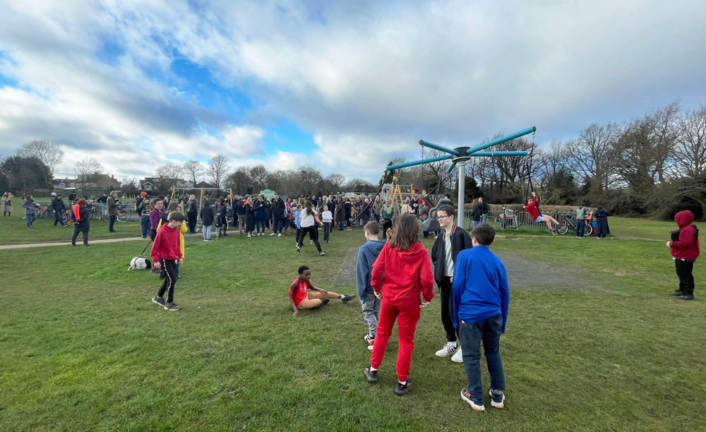
The event was attended by a large group of adults and children shown above. Enthusiastic children seemed desperate to get in to the area after the opening. Read more about the event on the Lets Play on Bernards Heath website. Very well done everyone involved.
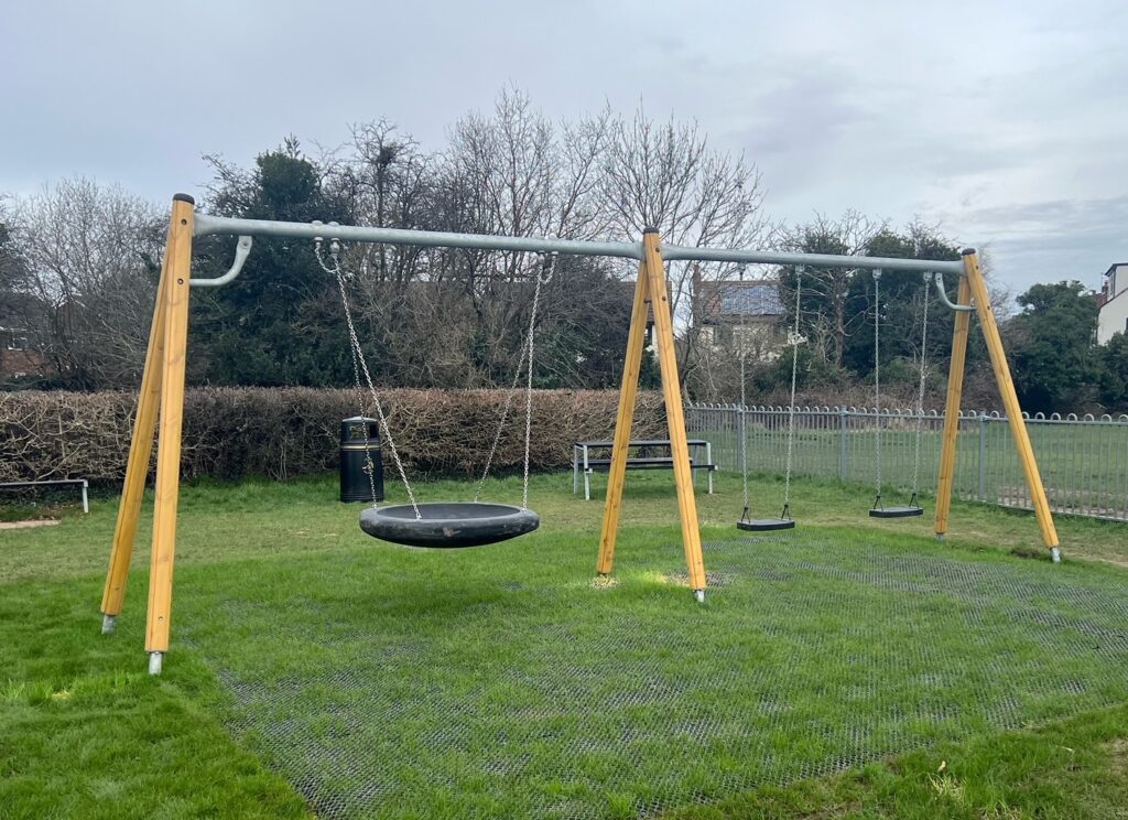
The new swings in the play area are now finished and mark the completion of the project.
Photo: DP
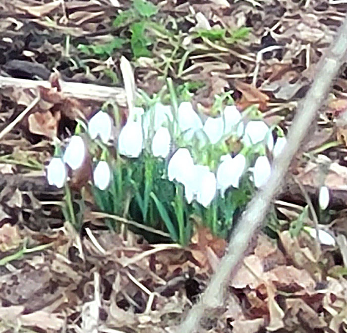
Better not speak too soon, but these snowdrops are doing well. You’ll find many more along by the Green Ring route soon. We’ve had quite a mild January and several sunny days already.
Thanks MN
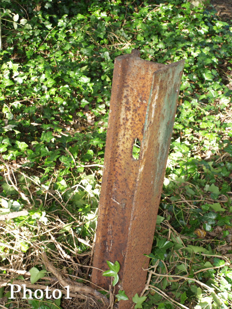
We had an intriguing find on the Heath after our last Action Day. Ivy was cut back from some trees and in one location, near the top end of Heath Farm Lane, it was found to have been concealing, instead of wood, a steel post set in the ground. Not ordinary angle-iron or
‘ T ‘- section, but a piece of rail line and more specifically, tram line (photos 1 and ‘Read More’ below 2 and 3).

Find out about a selection of events in 2023 by clicking ‘Continue reading’ below
Continue reading “Happy New Year 2024”“It is happening at last! The playground is closed for work to begin on its refurbishment.


Click on an image and use > or < keys to navigate. Click X (top right) to exit.
The target of £100,000 is now just a whisker away, a fantastic effort by the whole community!
With the refurbishment underway, the new playground will be ready in January, well before the Spring deadline.
Let’s Play at Bernards Heath would like to thank all those who have donated to help make this dream a reality.”
Photos and text: DP